Geolocate

Botkinburg topographic map

Click on the map to display elevation.

About this map

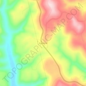
Name: Botkinburg topographic map, elevation, terrain.

Location: Botkinburg, Van Buren County, Arkansas, 72629, United States (35.67897 -92.53710 35.71897 -92.49710)

Average elevation: 379 m

Minimum elevation: 218 m

Maximum elevation: 535 m

Gear up for your next adventure:

🧭Orienteering Kit - Tools for map reading and navigation in the wild
Lightweight Backpacking Tent - Compact tent for efficient hiking trips
🧥Thermal Fleece Jacket - Versatile insulation for changing mountain temperatures
🧴Waterproofing Spray - Restore the DWR coating on jackets and tents
🥾Light Hiking Boots - Lightweight and comfortable boots for day hikes

As an Amazon Associate, this site earns from qualifying purchases at no extra cost to you.