Geolocate

Hyder topographic map

Click on the map to display elevation.

About this map

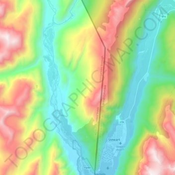
Name: Hyder topographic map, elevation, terrain.

Location: Hyder, Unorganized Borough, Alaska, 99923, United States (55.91120 -130.07683 56.04406 -130.00349)

Average elevation: 692 m

Minimum elevation: -7 m

Maximum elevation: 1,954 m

Gear up for your next adventure:

🧦Crew Hiking Socks - Comfortable socks for long-distance hikes
💡Portable Camping Lamp - Rechargeable lamp for campsite lighting
🔪Outdoor Multitool - Versatile tool for repairs and food prep in the wild
🧰Multitool Knife - Compact and versatile tool for outdoor use
🪜Heavy Duty Carabiners - Multi-use clips for securing gear to your backpack

As an Amazon Associate, this site earns from qualifying purchases at no extra cost to you.