Geolocate

Pendenza topographic map

Click on the map to display elevation.

About this map
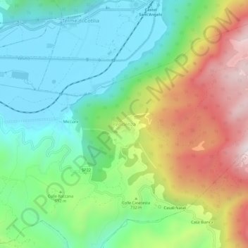
Name: Pendenza topographic map, elevation, terrain.

Location: Pendenza, Cittaducale, Rieti, Lazio, Italia (42.34041 12.99183 42.38041 13.03183)

Average elevation: 680 m

Minimum elevation: 399 m

Maximum elevation: 1,191 m

Gear up for your next adventure:

🥽Outdoor Goggles - Protective eyewear for outdoor activities
🛏️Sleeping Bag - Warm and compact sleeping bags for outdoor camping
🧥Ultralight Puffy Jacket - Maximum warmth that packs down to the size of an orange
📷Outdoor Action Camera - Capture high-elevation views and rugged adventures
🥾Trekking Boots - Durable boots for long-distance trekking

As an Amazon Associate, this site earns from qualifying purchases at no extra cost to you.