Geolocate

La Rotonda topographic map

Click on the map to display elevation.

About this map

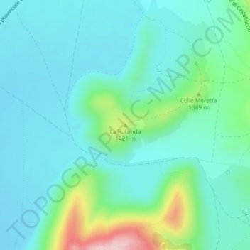
Name: La Rotonda topographic map, elevation, terrain.

Location: La Rotonda, Norcia, Perugia, Umbria, 06046, Italy (42.79846 13.21977 42.79856 13.21987)

Average elevation: 1,326 m

Minimum elevation: 1,271 m

Maximum elevation: 1,547 m

Gear up for your next adventure:

🧥Softshell Jacket - Windproof and breathable jacket for hiking
💧Hydration Bladder - Hands-free hydration solution for long treks
🥾Trail Hiking Boots - Supportive boots for rough trails
🚲Handlebar Phone Mount - View topographic-map.com live while cycling
🥾Trail Running Boots - Durable shoes designed for trail running

As an Amazon Associate, this site earns from qualifying purchases at no extra cost to you.