Geolocate

Vindstad topographic map

Click on the map to display elevation.

About this map

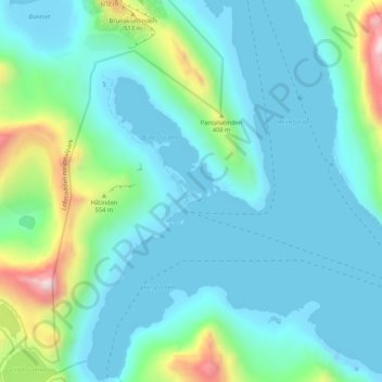
Name: Vindstad topographic map, elevation, terrain.

Location: Vindstad, Moskenes, Nordland, Norway (67.93932 12.98541 67.97932 13.02541)

Average elevation: 141 m

Minimum elevation: -45 m

Maximum elevation: 796 m

Gear up for your next adventure:

🥾Waterproof Hiking Boots - Essential footwear for rugged terrain and wet Canadian trails
🚲Heavy Duty Bike Lock - Secure your bike at the trailhead or during stops
🧢Hiking Sun Hat - Wide-brimmed protection for exposed mountain ridges
Family Camping Tent - Spacious tent suitable for family camping trips
🥾Waterproof Trail Shoes - Shoes designed to handle wet terrain

As an Amazon Associate, this site earns from qualifying purchases at no extra cost to you.