Geolocate

Stanley topographic map

Click on the map to display elevation.

About this map

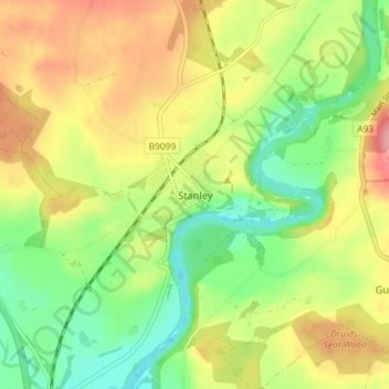
Name: Stanley topographic map, elevation, terrain.

Location: Stanley, Perth and Kinross, Scotland, PH1 4LY, United Kingdom (56.46119 -3.46664 56.50119 -3.42664)

Average elevation: 57 m

Minimum elevation: 7 m

Maximum elevation: 117 m

Gear up for your next adventure:

🥾Light Trekking Boots - Supportive boots for multi-day treks
🚲Heavy Duty Bike Lock - Secure your bike at the trailhead or during stops
🩹Moleskin Blister Pads - Direct protection for painful foot pressure points
🚑Survival Whistle - Signal for help across long distances in mountains
🥾Hiking Gaiters - Protect legs and shoes from mud, snow, and debris

As an Amazon Associate, this site earns from qualifying purchases at no extra cost to you.