
Thank you for supporting this site ❤️
Make a donation
Make a donation
Gear up for your next adventure:
As an Amazon Associate, this site earns from qualifying purchases at no extra cost to you.
Tidjet topographic map
Click on the map to display elevation.
Thank you for supporting this site ❤️
Make a donation
Make a donation
Gear up for your next adventure:
As an Amazon Associate, this site earns from qualifying purchases at no extra cost to you.
About this map
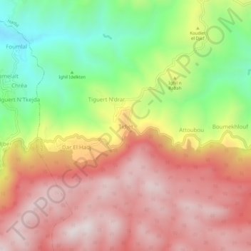
Name: Tidjet topographic map, elevation, terrain.
Location: Tidjet, Harbil, Daïra Guenzet, Sétif, Algérie (36.30873 4.86729 36.34873 4.90729)
Average elevation: 1,162 m
Minimum elevation: 734 m
Maximum elevation: 1,514 m
Thank you for supporting this site ❤️
Make a donation
Make a donation
Gear up for your next adventure:
As an Amazon Associate, this site earns from qualifying purchases at no extra cost to you.