
Thank you for supporting this site ❤️
Make a donation
Make a donation
Gear up for your next adventure:
As an Amazon Associate, this site earns from qualifying purchases at no extra cost to you.
Maissin topographic map
Click on the map to display elevation.
Thank you for supporting this site ❤️
Make a donation
Make a donation
Gear up for your next adventure:
As an Amazon Associate, this site earns from qualifying purchases at no extra cost to you.
About this map
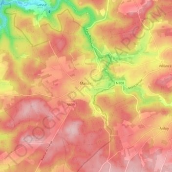
Name: Maissin topographic map, elevation, terrain.
Location: Maissin, Paliseul, Neufchâteau, Luxemburg, Wallonië, België (49.93502 5.12117 49.99320 5.19583)
Average elevation: 372 m
Minimum elevation: 257 m
Maximum elevation: 436 m
Thank you for supporting this site ❤️
Make a donation
Make a donation
Gear up for your next adventure:
As an Amazon Associate, this site earns from qualifying purchases at no extra cost to you.