Geolocate

King George topographic map

Click on the map to display elevation.

About this map

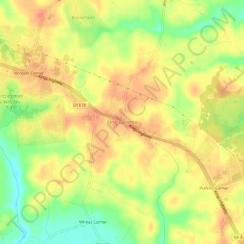
Name: King George topographic map, elevation, terrain.

Location: King George, King George County, Virginia, United States (38.24818 -77.20442 38.28818 -77.16442)

Average elevation: 47 m

Minimum elevation: 16 m

Maximum elevation: 66 m

Gear up for your next adventure:

🦟Insect Repellent - Keep mosquitoes and black flies away in wooded areas
🧢Hiking Hat - Sun-protective and breathable hats for long treks
🧢Outdoor Cap - Protective cap for sun and rain during hikes
🧦Thermal Socks - Warm socks for winter hiking or camping
🛏️Sleeping Bag - Warm and compact sleeping bags for outdoor camping

As an Amazon Associate, this site earns from qualifying purchases at no extra cost to you.