
Thank you for supporting this site ❤️
Make a donation
Make a donation
Gear up for your next adventure:
As an Amazon Associate, this site earns from qualifying purchases at no extra cost to you.
Kalayaan topographic map
Click on the map to display elevation.
Thank you for supporting this site ❤️
Make a donation
Make a donation
Gear up for your next adventure:
As an Amazon Associate, this site earns from qualifying purchases at no extra cost to you.
Kalayaan
The islets that comprise the municipality are generally flat. The highest ground elevation is approximately two meters above sea level.
Thank you for supporting this site ❤️
Make a donation
Make a donation
Gear up for your next adventure:
As an Amazon Associate, this site earns from qualifying purchases at no extra cost to you.
About this map
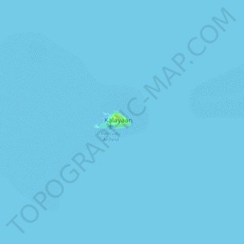
Name: Kalayaan topographic map, elevation, terrain.
Location: Kalayaan, Palawan, Mimaropa, 5322, Philippines (11.01354 114.24517 11.09354 114.32517)
Average elevation: 0 m
Minimum elevation: 0 m
Maximum elevation: 8 m
Thank you for supporting this site ❤️
Make a donation
Make a donation
Gear up for your next adventure:
As an Amazon Associate, this site earns from qualifying purchases at no extra cost to you.