
Thank you for supporting this site ❤️
Make a donation
Make a donation
Gear up for your next adventure:
As an Amazon Associate, this site earns from qualifying purchases at no extra cost to you.
Osøyro topographic map
Click on the map to display elevation.
Thank you for supporting this site ❤️
Make a donation
Make a donation
Gear up for your next adventure:
As an Amazon Associate, this site earns from qualifying purchases at no extra cost to you.
About this map
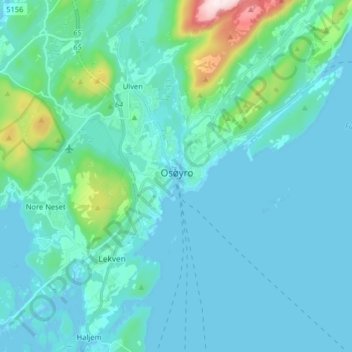
Name: Osøyro topographic map, elevation, terrain.
Location: Osøyro, Bjørnafjorden, Vestland, 5200, Norway (60.14514 5.42984 60.22514 5.50984)
Average elevation: 64 m
Minimum elevation: -4 m
Maximum elevation: 538 m
Thank you for supporting this site ❤️
Make a donation
Make a donation
Gear up for your next adventure:
As an Amazon Associate, this site earns from qualifying purchases at no extra cost to you.