Geolocate

Maynas topographic map

Click on the map to display elevation.

About this map

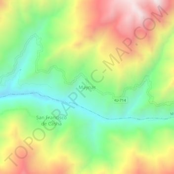
Name: Maynas topographic map, elevation, terrain.

Location: Maynas, Marías, Province of Dos de Mayo, Huánuco, Peru (-9.62564 -76.66688 -9.58564 -76.62688)

Average elevation: 3,841 m

Minimum elevation: 3,395 m

Maximum elevation: 4,439 m

Gear up for your next adventure:

🥾Waterproof Hiking Boots - Boots keeping your feet dry in wet conditions
🧦Hiking Socks - Moisture-wicking and comfortable socks for long hikes
🕶️Polarized Sunglasses - Protect your eyes with durable polarized lenses
🗺️Topographic Maps - Detailed maps to explore trails, mountains, and wilderness areas
🔥Camping Stove - Portable stoves to cook outdoors with ease

As an Amazon Associate, this site earns from qualifying purchases at no extra cost to you.