
Thank you for supporting this site ❤️
Make a donation
Make a donation
Gear up for your next adventure:
As an Amazon Associate, this site earns from qualifying purchases at no extra cost to you.
Raamsdonksveer topographic map
Click on the map to display elevation.
Thank you for supporting this site ❤️
Make a donation
Make a donation
Gear up for your next adventure:
As an Amazon Associate, this site earns from qualifying purchases at no extra cost to you.
About this map
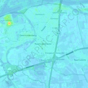
Name: Raamsdonksveer topographic map, elevation, terrain.
Location: Raamsdonksveer, Geertruidenberg, North Brabant, Netherlands (51.67184 4.84072 51.72015 4.90944)
Average elevation: 2 m
Minimum elevation: -4 m
Maximum elevation: 33 m
Thank you for supporting this site ❤️
Make a donation
Make a donation
Gear up for your next adventure:
As an Amazon Associate, this site earns from qualifying purchases at no extra cost to you.