
Lake Aquitaine topographic map
Interactive map
Click on the map to display elevation.
About this map
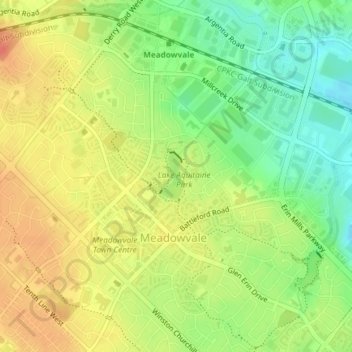
Name: Lake Aquitaine topographic map, elevation, terrain.
Average elevation: 193 m
Minimum elevation: 167 m
Maximum elevation: 214 m
Other topographic maps
Click on a map to view its topography, its elevation and its terrain.
Huron Heights Park
Canada > Ontario > Peel Region > Mississauga
Huron Heights Park, Mississauga, Peel Region, Golden Horseshoe, Ontario, Canada
Average elevation: 158 m
Marie Curtis Park
Canada > Ontario > Peel Region > Mississauga
Marie Curtis Park, Etobicoke, Mississauga, Peel Region, Golden Horseshoe, Ontario, Canada
Average elevation: 83 m
Mimico Creek
Canada > Ontario > Peel Region > Mississauga
Mimico Creek, Mississauga, Peel Region, Golden Horseshoe, Ontario, Canada
Average elevation: 161 m