
Van Anda topographic map
Click on the map to display elevation.
About this map
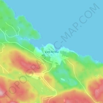
Name: Van Anda topographic map, elevation, terrain.
Average elevation: 49 m
Minimum elevation: -1 m
Maximum elevation: 172 m
qathet Regional District trails, hiking, mountain biking, running and outdoor activities
Other topographic maps
Click on a map to view its topography, its elevation and its terrain.
Texada Island
Canada > British Columbia > qathet Regional District > Area D (Texada Island)
Average elevation: 83 m
South Texada Island Provincial Park
Canada > British Columbia > qathet Regional District > Area D (Texada Island)
Average elevation: 190 m
Texada Island
Canada > British Columbia > qathet Regional District > Area D (Texada Island)
Average elevation: 83 m