Geolocate

Barr topographic map

Click on the map to display elevation.

About this map

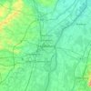
Name: Barr topographic map, elevation, terrain.

Location: Barr, Sélestat-Erstein, Bas-Rhin, Grand Est, Metropolitan France, 67140, France (48.39247 7.31647 48.43476 7.48125)

Average elevation: 301 m

Minimum elevation: 154 m

Maximum elevation: 829 m

Other topographic maps

Click on a map to view its topography, its elevation and its terrain.
Strasbourg

France > Grand Est > Bas-Rhin > Strasbourg

Average elevation: 154 m

Gear up for your next adventure:

💡Solar Camping Lamp - Eco-friendly lighting for campsites
🥾Light Hiking Boots - Lightweight and comfortable boots for day hikes
🧼Travel Hand Sanitizer - Keep hands clean when water is scarce
🧢Hiking Hat - Sun-protective and breathable hats for long treks
🥤Collapsible Travel Cup - Saves space and weight in your mess kit

As an Amazon Associate, this site earns from qualifying purchases at no extra cost to you.