
Río Riosa topographic map
Interactive map
Click on the map to display elevation.
About this map
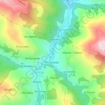
Name: Río Riosa topographic map, elevation, terrain.
Location: Río Riosa, Prunadiella, L' Ará, Riosa, Asturias, 33160, España (43.22981 -5.88308 43.24166 -5.87334)
Average elevation: 467 m
Minimum elevation: 258 m
Maximum elevation: 797 m