Geolocate

Lato topographic map

Click on the map to display elevation.

About this map

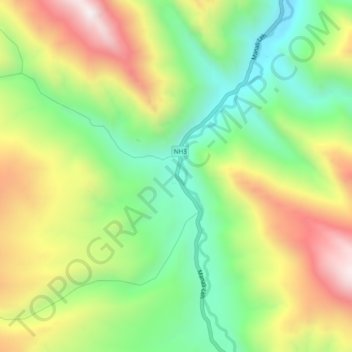
Name: Lato topographic map, elevation, terrain.

Location: Lato, Leh Tehsil, Leh district, Ladakh, India (33.65918 77.70850 33.69918 77.74850)

Average elevation: 4,268 m

Minimum elevation: 3,859 m

Maximum elevation: 4,818 m

Other topographic maps

Click on a map to view its topography, its elevation and its terrain.

Gear up for your next adventure:

🧭GPS Handheld Device - Reliable GPS navigation for outdoor adventures
🚑Survival Whistle - Signal for help across long distances in mountains
🥾Waterproof Hiking Boots - Essential footwear for rugged terrain and wet Canadian trails
🧊Portable Cooler - Keep food and drinks cold during outdoor adventures
🥾Trail Running Boots - Durable shoes designed for trail running

As an Amazon Associate, this site earns from qualifying purchases at no extra cost to you.