
Skoura topographic map
Interactive map
Click on the map to display elevation.
About this map
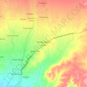
Name: Skoura topographic map, elevation, terrain.
Average elevation: 1,223 m
Minimum elevation: 1,157 m
Maximum elevation: 1,283 m
Other topographic maps
Click on a map to view its topography, its elevation and its terrain.
Ouled Said
Maroc > cercle d'Ouarzazate > Skoura Ahl El Oust > Ouled Said
Ouled Said, Skoura Ahl El Oust, caïdat de Skoura, cercle d'Ouarzazate, Province de Ouarzazate, Drâa-Tafilalet, 45502, Maroc
Average elevation: 1,208 m