Geolocate

Moies topographic map

Click on the map to display elevation.

About this map

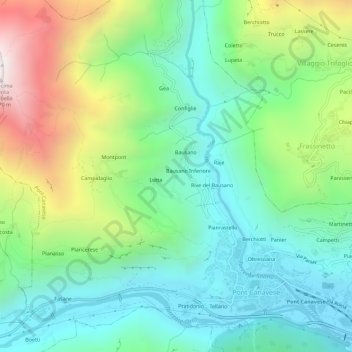
Name: Moies topographic map, elevation, terrain.

Location: Moies, Pont Canavese, Torino, Piemonte, 10080, Italia (45.41374 7.56388 45.45374 7.60388)

Average elevation: 872 m

Minimum elevation: 427 m

Maximum elevation: 1,866 m

Gear up for your next adventure:

🔪Outdoor Multitool - Versatile tool for repairs and food prep in the wild
🎒Backpack Rain Cover - External shield to keep your entire pack dry
🧶550 Survival Paracord - Versatile utility cord for emergency repairs and rigging
👟Trail Running Shoes - Agile footwear for fast-paced topographic exploration
🧥Thermal Fleece Jacket - Versatile insulation for changing mountain temperatures

As an Amazon Associate, this site earns from qualifying purchases at no extra cost to you.