Geolocate

Bateshwar topographic map

Click on the map to display elevation.

About this map

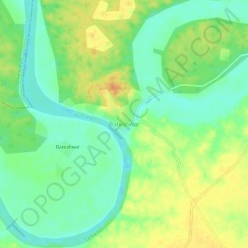
Name: Bateshwar topographic map, elevation, terrain.

Location: Bateshwar, Bah, Agra division, Uttar Pradesh, India (26.91532 78.52357 26.95532 78.56357)

Average elevation: 144 m

Minimum elevation: 126 m

Maximum elevation: 167 m

Gear up for your next adventure:

🎒Fully Waterproof Backpack - Total protection for photography gear and electronics
Lightweight Camping Tent - Portable shelter optimized for Canadian backcountry camping
🧭GPS Outdoor Watch - Smart watch for navigation and fitness tracking in nature
🛁Quick-Dry Microfiber Towel - Space-saving towel that dries rapidly on the move
🔨Vehicle Emergency Tool - Safety tool for remote road trips to trailheads

As an Amazon Associate, this site earns from qualifying purchases at no extra cost to you.