Geolocate

Dr. Phillips topographic map

Click on the map to display elevation.

About this map

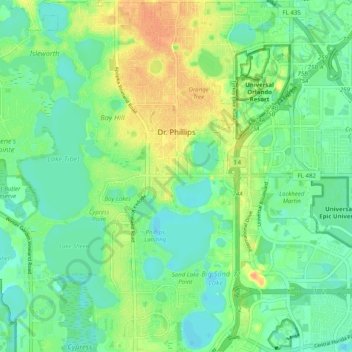
Name: Dr. Phillips topographic map, elevation, terrain.

Location: Dr. Phillips, Orange County, Florida, United States (28.40595 -81.52344 28.49371 -81.47461)

Average elevation: 34 m

Minimum elevation: 21 m

Maximum elevation: 56 m

Other topographic maps

Click on a map to view its topography, its elevation and its terrain.

Orlando

United States > Florida > Orange County

Average elevation: 29 m

Christmas

United States > Florida > Orange County

Average elevation: 15 m

Lockwood

United States > Florida > Orange County

Average elevation: 20 m

McKay Lake

United States > Florida > Orange County

Average elevation: 29 m

Doe Lake

United States > Florida > Orange County

Average elevation: 36 m

Gear up for your next adventure:

🎒Hiking Daypack - Lightweight and durable backpacks for day trips and excursions
🦌Outdoor Trail Camera - Monitor wildlife activity near your favorite spots
🥾Waterproof Hiking Boots - Essential footwear for rugged terrain and wet Canadian trails
🧰Emergency Multi-Tool - Compact multi-tool for outdoor survival
Lightweight Backpacking Tent - Compact tent for efficient hiking trips

As an Amazon Associate, this site earns from qualifying purchases at no extra cost to you.