
Las Tolleras topographic map
Interactive map
Click on the map to display elevation.
About this map
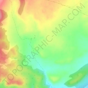
Name: Las Tolleras topographic map, elevation, terrain.
Location: Las Tolleras, Albacete, Castilla-La Mancha, España (38.73731 -1.45480 38.75731 -1.43480)
Average elevation: 861 m
Minimum elevation: 815 m
Maximum elevation: 909 m
Other topographic maps
Click on a map to view its topography, its elevation and its terrain.
Albacete
España > Castilla-La Mancha > Albacete
Albacete, Castilla-La Mancha, 02001, España
Average elevation: 717 m
Campillo de las Doblas
España > Castilla-La Mancha > Albacete > Campillo de las Doblas
Campillo de las Doblas, Albacete, Castilla-La Mancha, 02511, España
Average elevation: 855 m
La Pulgosa
España > Castilla-La Mancha > Albacete
La Pulgosa, Albacete, Castilla-La Mancha, 02006, España
Average elevation: 692 m