Geolocate

Lyndhurst topographic map

Click on the map to display elevation.

About this map

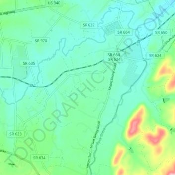
Name: Lyndhurst topographic map, elevation, terrain.

Location: Lyndhurst, Augusta County, Virginia, United States (37.98840 -78.98004 38.04949 -78.92332)

Average elevation: 446 m

Minimum elevation: 396 m

Maximum elevation: 657 m

Gear up for your next adventure:

🥾Mountain Hiking Shoes - Shoes with superior grip for mountainous terrain
🪑Ultralight Camping Stool - Compact seating for rest stops during long hikes
🕯️Camping Lantern - Illuminates your entire campsite with high-efficiency LEDs
🥾Mountain Hiking Boots - High-traction boots for rocky terrain
🩹Moleskin Blister Pads - Direct protection for painful foot pressure points

As an Amazon Associate, this site earns from qualifying purchases at no extra cost to you.