Geolocate

Ciscar topographic map

Click on the map to display elevation.

About this map

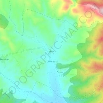
Name: Ciscar topographic map, elevation, terrain.

Location: Ciscar, Benabarre, La Ribagorza, Huesca, Aragón, 22585, España (42.05637 0.52932 42.09637 0.56932)

Average elevation: 630 m

Minimum elevation: 533 m

Maximum elevation: 852 m

Gear up for your next adventure:

🧰Multitool Knife - Compact and versatile tool for outdoor use
🔥Emergency Fire Starter - Reliable ignition source for all weather conditions
🧥Thermal Layer - Insulating layer for cold outdoor conditions
💡Compact LED Flashlight - Powerful and portable flashlight for outdoor use
🧊Insulated Water Bottle - Keeps drinks cold in summer and prevents freezing in winter

As an Amazon Associate, this site earns from qualifying purchases at no extra cost to you.