
Thank you for supporting this site ❤️
Make a donation
Make a donation
Gear up for your next adventure:
As an Amazon Associate, this site earns from qualifying purchases at no extra cost to you.
Guacalito topographic map
Click on the map to display elevation.
Thank you for supporting this site ❤️
Make a donation
Make a donation
Gear up for your next adventure:
As an Amazon Associate, this site earns from qualifying purchases at no extra cost to you.
About this map
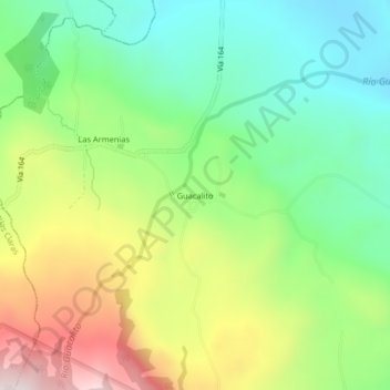
Name: Guacalito topographic map, elevation, terrain.
Location: Guacalito, Canalete, Upala, Alajuela, 21308, Costa Rica (10.79314 -85.13241 10.83314 -85.09241)
Average elevation: 505 m
Minimum elevation: 259 m
Maximum elevation: 903 m
Thank you for supporting this site ❤️
Make a donation
Make a donation
Gear up for your next adventure:
As an Amazon Associate, this site earns from qualifying purchases at no extra cost to you.