Geolocate

Tatala topographic map

Click on the map to display elevation.

About this map

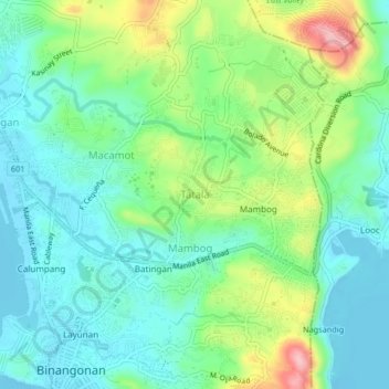
Name: Tatala topographic map, elevation, terrain.

Location: Tatala, Binangonan, Rizal, Calabarzon, 1904, Philippines (14.46281 121.18551 14.50281 121.22551)

Average elevation: 52 m

Minimum elevation: -8 m

Maximum elevation: 176 m

Other topographic maps

Click on a map to view its topography, its elevation and its terrain.

Libis

Philippines > Rizal > Binangonan

Average elevation: 10 m

Calumpang

Philippines > Rizal > Binangonan > Macamot

Average elevation: 16 m

Talim

Philippines > Rizal > Binangonan

Average elevation: 13 m

Gear up for your next adventure:

🛌Down Sleeping Bag - Superior warmth-to-weight ratio for cold nights
🛁Quick-Dry Microfiber Towel - Space-saving towel that dries rapidly on the move
🪑Insulated Seat Pad - Protect your seat from cold rocks and wet logs
🦶Anti-Blister Balm - Prevents friction and hotspots during long ascents
Camping Groundsheet - Protect your tent from moisture and dirt

As an Amazon Associate, this site earns from qualifying purchases at no extra cost to you.