Geolocate

Newville topographic map

Click on the map to display elevation.

About this map

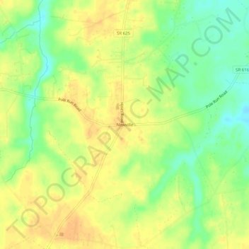
Name: Newville topographic map, elevation, terrain.

Location: Newville, Prince George County, Virginia, United States (37.16515 -77.16719 37.20515 -77.12719)

Average elevation: 30 m

Minimum elevation: 12 m

Maximum elevation: 41 m

Gear up for your next adventure:

Bushcraft Tarp - Versatile emergency shelter or gear protection
🩹Moleskin Blister Pads - Direct protection for painful foot pressure points
🧥Waterproof Pants - Keep dry during rainy hiking conditions
🧴Waterproofing Spray - Restore the DWR coating on jackets and tents
🧰Multitool Knife - Compact and versatile tool for outdoor use

As an Amazon Associate, this site earns from qualifying purchases at no extra cost to you.