Geolocate

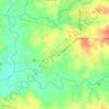
Mahabang Parang topographic map

Click on the map to display elevation.

About this map

Name: Mahabang Parang topographic map, elevation, terrain.

Location: Mahabang Parang, Santa Maria, Bulacan, Central Luzon, Philippines (14.78443 120.95003 14.80465 120.96658)

Average elevation: 17 m

Minimum elevation: 5 m

Maximum elevation: 36 m

Other topographic maps

Click on a map to view its topography, its elevation and its terrain.
Ibayong Tabon

Philippines > Bulacan > Santa Maria

Average elevation: 26 m

Catmon

Philippines > Bulacan > Santa Maria

Average elevation: 31 m

Pulong Yantok

Philippines > Bulacan > Santa Maria

Average elevation: 67 m

Manggahan

Philippines > Bulacan > Santa Maria

Average elevation: 24 m

Catmon

Philippines > Bulacan > Santa Maria

Average elevation: 31 m

Pulong Yantok

Philippines > Bulacan > Santa Maria

Average elevation: 67 m

Manggahan

Philippines > Bulacan > Santa Maria

Average elevation: 24 m

Manggahan

Philippines > Bulacan > Santa Maria

Average elevation: 24 m

Manggahan

Philippines > Bulacan > Santa Maria

Average elevation: 24 m

Gear up for your next adventure:

⛺Backpacking Tent - Lightweight tent for long-distance hiking trips
🧢Sun Protection Cap - Breathable cap to protect from sun exposure
☕Camping Coffee Maker - Brew fresh coffee anywhere on the topographic map
🧥Ultralight Puffy Jacket - Maximum warmth that packs down to the size of an orange
🧰Emergency Multi-Tool - Compact multi-tool for outdoor survival

As an Amazon Associate, this site earns from qualifying purchases at no extra cost to you.