Geolocate

Gracias topographic map

Click on the map to display elevation.

About this map
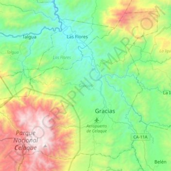
Name: Gracias topographic map, elevation, terrain.

Location: Gracias, Lempira, Honduras (14.51085 -88.77748 14.74812 -88.49504)

Average elevation: 1,169 m

Minimum elevation: 452 m

Maximum elevation: 2,831 m

Gear up for your next adventure:

🔨Vehicle Emergency Tool - Safety tool for remote road trips to trailheads
🔭Compact Monocular - One-handed bird watching and trail spotting
🩹Compact First Aid Kit - Pre-packed essentials for common trail injuries
🐕Hiking Dog Pack - Let your canine companion carry their own water and food
🥾Hiking Boots - Sturdy boots providing ankle support and traction on rugged trails

As an Amazon Associate, this site earns from qualifying purchases at no extra cost to you.