Geolocate

Lebanon topographic map

Click on the map to display elevation.

About this map

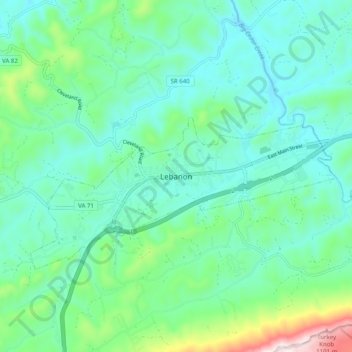
Name: Lebanon topographic map, elevation, terrain.

Location: Lebanon, Russell County, Virginia, 24266, United States (36.86091 -82.12013 36.94091 -82.04013)

Average elevation: 681 m

Minimum elevation: 556 m

Maximum elevation: 1,146 m

Gear up for your next adventure:

🥾Hiking Leggings - Comfortable leggings for outdoor activities
🛶Kayak Accessories - Essential gear for safe and fun kayaking adventures
🥾Durable Hiking Shoes - Long-lasting shoes for frequent hiking
🧥Fleece Jacket - Warm and lightweight jacket for layering
🛌Insulated Sleeping Pad - Critical thermal barrier between you and the cold ground

As an Amazon Associate, this site earns from qualifying purchases at no extra cost to you.