Geolocate

Tortosa topographic map

Click on the map to display elevation.

About this map
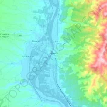
Name: Tortosa topographic map, elevation, terrain.

Location: Tortosa, Baix Ebre, Tarragona, Catalonia, 43500, Spain (40.77102 0.48093 40.85102 0.56093)

Average elevation: 77 m

Minimum elevation: -1 m

Maximum elevation: 373 m

Gear up for your next adventure:

🚲MTB Frame Bag - Carry tools and maps directly on your bicycle frame
🎒Backpack Rain Cover - External shield to keep your entire pack dry
🗺️Topographic Maps - Detailed maps to explore trails, mountains, and wilderness areas
🧴Outdoor Sunscreen - High SPF protection for high-altitude UV exposure
🥾Trail Hiking Boots - Supportive boots for rough trails

As an Amazon Associate, this site earns from qualifying purchases at no extra cost to you.