Geolocate

Mercaderes topographic map

Click on the map to display elevation.

About this map

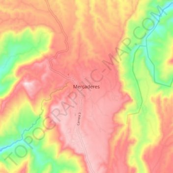
Name: Mercaderes topographic map, elevation, terrain.

Location: Mercaderes, Sur, Cauca, Colombia (1.75849 -77.20107 1.83849 -77.12107)

Average elevation: 1,015 m

Minimum elevation: 696 m

Maximum elevation: 1,241 m

Gear up for your next adventure:

🧦Hiking Socks - Moisture-wicking and comfortable socks for long hikes
🧥Ultralight Puffy Jacket - Maximum warmth that packs down to the size of an orange
🕶️Polarized Sunglasses - Protect your eyes with durable polarized lenses
🥽Outdoor Goggles - Protective eyewear for outdoor activities
🛰️Satellite Messenger - Emergency communication for areas with no cell service

As an Amazon Associate, this site earns from qualifying purchases at no extra cost to you.