
Thank you for supporting this site ❤️
Make a donation
Make a donation
Gear up for your next adventure:
As an Amazon Associate, this site earns from qualifying purchases at no extra cost to you.
Ngahere topographic map
Click on the map to display elevation.
Thank you for supporting this site ❤️
Make a donation
Make a donation
Gear up for your next adventure:
As an Amazon Associate, this site earns from qualifying purchases at no extra cost to you.
About this map
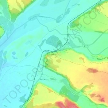
Name: Ngahere topographic map, elevation, terrain.
Location: Ngahere, Grey District, West Coast, 7804, New Zealand (-42.41513 171.42319 -42.37513 171.46319)
Average elevation: 49 m
Minimum elevation: 24 m
Maximum elevation: 107 m
Thank you for supporting this site ❤️
Make a donation
Make a donation
Gear up for your next adventure:
As an Amazon Associate, this site earns from qualifying purchases at no extra cost to you.