
Robregordo topographic map
Interactive map
Click on the map to display elevation.
About this map
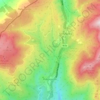
Name: Robregordo topographic map, elevation, terrain.
Location: Robregordo, Sierra Norte, Comunidad de Madrid, Spanje (41.09515 -3.64361 41.15210 -3.56549)
Average elevation: 1,502 m
Minimum elevation: 1,132 m
Maximum elevation: 1,907 m