
Alps topographic map
Click on the map to display elevation.
Alps
The altitude and size of the range affects the climate in Europe; in the mountains precipitation levels vary greatly and climatic conditions consist of distinct zones. Wildlife such as ibex live in the higher peaks to elevations of 3,400 m (11,155 ft), and plants such as Edelweiss grow in rocky areas in lower elevations as well as in higher elevations. Evidence of human habitation in the Alps goes back to the Palaeolithic era. A mummified man, determined to be 5,000 years old, was discovered on a glacier at the Austrian–Italian border in 1991.
About this map
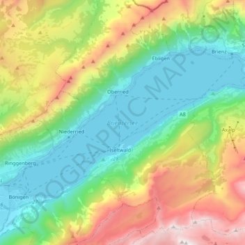
Name: Alps topographic map, elevation, terrain.
Location: Alps, Brienzersee, Bellagio, Como, Lombardy, 3855, Italy (46.68797 7.88470 46.75796 8.04990)
Average elevation: 1,284 m
Minimum elevation: 555 m
Maximum elevation: 2,703 m