
Thank you for supporting this site ❤️
Make a donation
Make a donation
Gear up for your next adventure:
As an Amazon Associate, this site earns from qualifying purchases at no extra cost to you.
Llóngara topographic map
Click on the map to display elevation.
Thank you for supporting this site ❤️
Make a donation
Make a donation
Gear up for your next adventure:
As an Amazon Associate, this site earns from qualifying purchases at no extra cost to you.
About this map
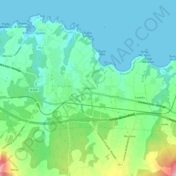
Name: Llóngara topographic map, elevation, terrain.
Location: Llóngara, A Caridá, El Franco, Asturien, 33750, Spanien (43.53048 -6.84157 43.57048 -6.80157)
Average elevation: 55 m
Minimum elevation: -1 m
Maximum elevation: 223 m
Thank you for supporting this site ❤️
Make a donation
Make a donation
Gear up for your next adventure:
As an Amazon Associate, this site earns from qualifying purchases at no extra cost to you.