
Ulmet topographic map
Interactive map
Click on the map to display elevation.
About this map
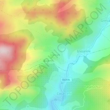
Name: Ulmet topographic map, elevation, terrain.
Location: Ulmet, Bozioru, Buzău, 127084, Rumänien (45.36491 26.46659 45.36992 26.47398)
Average elevation: 453 m
Minimum elevation: 292 m
Maximum elevation: 692 m
Other topographic maps
Click on a map to view its topography, its elevation and its terrain.