Geolocate

Pisa topographic map

Click on the map to display elevation.

About this map

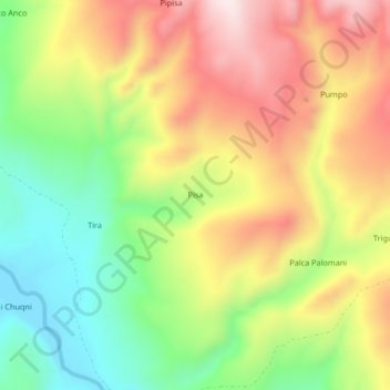
Name: Pisa topographic map, elevation, terrain.

Location: Pisa, Callalli, Province of Caylloma, Arequipa, Peru (-15.49699 -71.21419 -15.45699 -71.17419)

Average elevation: 4,450 m

Minimum elevation: 4,208 m

Maximum elevation: 4,716 m

Gear up for your next adventure:

🧥Ultralight Puffy Jacket - Maximum warmth that packs down to the size of an orange
🩹Compact First Aid Kit - Pre-packed essentials for common trail injuries
💡Portable Camping Lamp - Rechargeable lamp for campsite lighting
🔥Emergency Fire Starter - Reliable ignition source for all weather conditions
🚲Heavy Duty Bike Lock - Secure your bike at the trailhead or during stops

As an Amazon Associate, this site earns from qualifying purchases at no extra cost to you.