
Make a donation
Gear up for your next adventure:
As an Amazon Associate, this site earns from qualifying purchases at no extra cost to you.
Middelburg topographic map
Click on the map to display elevation.
Make a donation
Gear up for your next adventure:
As an Amazon Associate, this site earns from qualifying purchases at no extra cost to you.
Middelburg
Middelburg is gesitueerd in het Meetjesland, in het zeekleipoldergebied vlak bij de Belgisch-Nederlandse grens die hier wordt gevormd door de Papenkreek en de Meulekreek. De hoogte bedraagt ongeveer 2 meter. Zuidelijk van Middelburg vindt men de parallel verlopende kanalen Leopoldkanaal en Schipdonkkanaal.
Make a donation
Gear up for your next adventure:
As an Amazon Associate, this site earns from qualifying purchases at no extra cost to you.
About this map
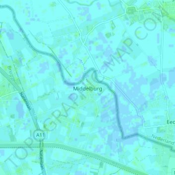
Name: Middelburg topographic map, elevation, terrain.
Average elevation: 1 m
Minimum elevation: -2 m
Maximum elevation: 4 m
Make a donation
Gear up for your next adventure:
As an Amazon Associate, this site earns from qualifying purchases at no extra cost to you.
Other topographic maps
Click on a map to view its topography, its elevation and its terrain.