Geolocate

San Felipe topographic map

Click on the map to display elevation.

About this map

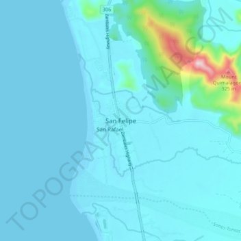
Name: San Felipe topographic map, elevation, terrain.

Location: San Felipe, Zambales, Central Luzon, 2204, Philippines (15.02106 120.03028 15.10106 120.11028)

Average elevation: 32 m

Minimum elevation: -2 m

Maximum elevation: 383 m

Gear up for your next adventure:

🧴Waterproofing Spray - Restore the DWR coating on jackets and tents
🗺️Topographic Maps - Detailed maps to explore trails, mountains, and wilderness areas
🥾Hiking Leggings - Comfortable leggings for outdoor activities
🥾Mountain Hiking Boots - High-traction boots for rocky terrain
💧Filtered Water Bottle - Safe drinking water on the go

As an Amazon Associate, this site earns from qualifying purchases at no extra cost to you.