Geolocate

Delme topographic map

Click on the map to display elevation.

Delme

Delme is located 30 km to the southeast of Metz and 27 km northeast of Nancy. Next communes: Tincry and Prévocourt in the northeast, Viviers in the east, Donjeux, Laneuveville-en-Saulnois and Oriocourt in the southeast, Lemoncourt in the south, Puzieux, Alaincourt-la-Côte and Xocourt in the northwest. Its area is 5.09 km2 and its elevation ranges between 208 and 280 m.

Wikipedia (CC-BY-SA 3.0)

About this map

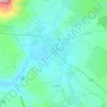
Name: Delme topographic map, elevation, terrain.

Location: Delme, Sarrebourg-Château-Salins, Moselle, Grand Est, Metropolitan France, 57590, France (48.87004 6.35526 48.89871 6.41017)

Average elevation: 244 m

Minimum elevation: 209 m

Maximum elevation: 382 m

Other topographic maps

Click on a map to view its topography, its elevation and its terrain.

Helling

France > Grand Est > Moselle

Average elevation: 243 m

Biévre

France > Grand Est > Moselle > Walscheid

Average elevation: 413 m

Cité Émile Huchet

France > Grand Est > Moselle > Saint-Avold

Average elevation: 253 m

Rhodes

France > Grand Est > Moselle > Rhodes

Average elevation: 267 m

Gear up for your next adventure:

🧭GPS Tracker - Track your location in remote areas safely
🥾Light Trekking Boots - Supportive boots for multi-day treks
🥾Hiking Shoes - Durable and comfortable shoes for trail hiking
🛶Waterproof Dry Bags - Keep electronics and clothes dry during river crossings
🌡️Emergency Mylar Blankets - Compact thermal protection for unexpected nights outdoors

As an Amazon Associate, this site earns from qualifying purchases at no extra cost to you.