Geolocate

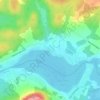
Chesterville topographic map

Click on the map to display elevation.

About this map

Name: Chesterville topographic map, elevation, terrain.

Location: Chesterville, Arthabaska, Centre-du-Québec, Québec, G0P 1J0, Canada (45.90124 -71.87915 46.03450 -71.68251)

Average elevation: 288 m

Minimum elevation: 127 m

Maximum elevation: 532 m

Other topographic maps

Click on a map to view its topography, its elevation and its terrain.

Defoy

Canada > Québec > Arthabaska

Average elevation: 97 m

Mont Proulx

Canada > Québec > Arthabaska > Kingsey Falls

Average elevation: 165 m

Domaine-de-la-Halte

Canada > Québec > Arthabaska > Chesterville

Average elevation: 248 m

Gear up for your next adventure:

🛌Down Sleeping Bag - Superior warmth-to-weight ratio for cold nights
🧴Outdoor Sunscreen - High SPF protection for high-altitude UV exposure
🧊Insulated Water Bottle - Keeps drinks cold in summer and prevents freezing in winter
🛏️Camping Sleeping Mat - Comfortable mats for sleeping outdoors
🥾Light Hiking Boots - Lightweight and comfortable boots for day hikes

As an Amazon Associate, this site earns from qualifying purchases at no extra cost to you.