Geolocate

Florián topographic map

Click on the map to display elevation.

Florián

La cuenca del río Minero constituye un ecosistema productor hídrico ecológico determinado por la dinámica climática. El río Minero nace en Cundinamarca en las cabeceras del Páramo del Ratón, a una altitud de 3600 m s. n. m.; atraviesa a Boyacá y Santander y toma el nombre del Carare al unirse con el río Orca y desembocar en el río Magdalena.

Wikipedia (CC-BY-SA 3.0)

About this map

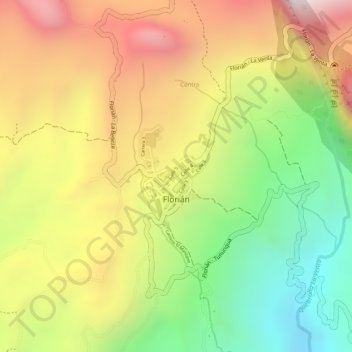
Name: Florián topographic map, elevation, terrain.

Location: Florián, Vélez, Santander, RAP Gran Santander, 684541, Colombia (5.80008 -73.97442 5.80824 -73.96835)

Average elevation: 1,571 m

Minimum elevation: 1,114 m

Maximum elevation: 2,000 m

Other topographic maps

Click on a map to view its topography, its elevation and its terrain.

El Carmen

Colombia > Santander > Florián

Average elevation: 1,240 m

Viani

Colombia > Santander > Florián

Average elevation: 1,268 m

Gear up for your next adventure:

🦯Trekking Poles - Reduced impact on joints for steep topographic climbs
🛰️Satellite Messenger - Emergency communication for areas with no cell service
🛌Down Sleeping Bag - Superior warmth-to-weight ratio for cold nights
🛶Kayak Dry Bag - Waterproof storage for kayaking adventures
🧥Waterproof Hiking Jacket - Protect yourself from rain and wind while hiking

As an Amazon Associate, this site earns from qualifying purchases at no extra cost to you.