Geolocate

Kemer topographic map

Click on the map to display elevation.

About this map

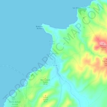
Name: Kemer topographic map, elevation, terrain.

Location: Kemer, Biga, Canakkale, Marmara Region, Turkey (40.39779 27.04711 40.43779 27.08711)

Average elevation: 25 m

Minimum elevation: -1 m

Maximum elevation: 128 m

Gear up for your next adventure:

Family Camping Tent - Spacious tent suitable for family camping trips
🛏️Sleeping Bag - Warm and compact sleeping bags for outdoor camping
🧢Sun Hat - Wide-brim hat for sun protection
🛰️Satellite Messenger - Emergency communication for areas with no cell service
🧥Softshell Hiking Jacket - The perfect balance of wind protection and breathability

As an Amazon Associate, this site earns from qualifying purchases at no extra cost to you.