
Thank you for supporting this site ❤️
Make a donation
Make a donation
Gear up for your next adventure:
As an Amazon Associate, this site earns from qualifying purchases at no extra cost to you.
Saraikela topographic map
Click on the map to display elevation.
Thank you for supporting this site ❤️
Make a donation
Make a donation
Gear up for your next adventure:
As an Amazon Associate, this site earns from qualifying purchases at no extra cost to you.
About this map
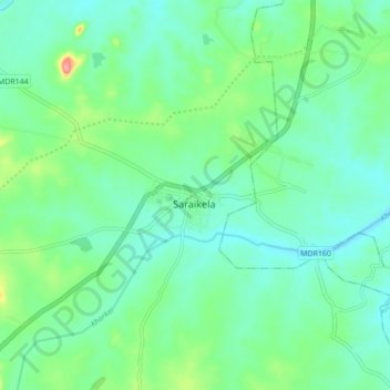
Name: Saraikela topographic map, elevation, terrain.
Location: Saraikela, Seraikela Kharsawan, Jharkhand, 833219, India (22.65964 85.89126 22.73964 85.97126)
Average elevation: 178 m
Minimum elevation: 153 m
Maximum elevation: 254 m
Thank you for supporting this site ❤️
Make a donation
Make a donation
Gear up for your next adventure:
As an Amazon Associate, this site earns from qualifying purchases at no extra cost to you.