Geolocate

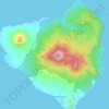
Mount Babuyan topographic map

Click on the map to display elevation.

About this map

Name: Mount Babuyan topographic map, elevation, terrain.

Location: Mount Babuyan, Calayan, Cagayan, Cagayan Valley, Philippines (19.53821 121.91256 19.53831 121.91266)

Average elevation: 208 m

Minimum elevation: 0 m

Maximum elevation: 680 m

Other topographic maps

Click on a map to view its topography, its elevation and its terrain.

Sibang Cove

Philippines > Cagayan > Calayan > Dadao

Average elevation: 56 m

Babuyan Island

Philippines > Cagayan > Calayan

Average elevation: 185 m

Babuyan Island

Philippines > Cagayan > Calayan

Average elevation: 185 m

Gear up for your next adventure:

🥾Trail Hiking Boots - Supportive boots for rough trails
🧭Orienteering Kit - Tools for map reading and navigation in the wild
⛺Backpacking Tent - Lightweight tent for long-distance hiking trips
🥾Approach Shoes - Shoes designed for climbing approaches and rugged trails
🔪Outdoor Multitool - Versatile tool for repairs and food prep in the wild

As an Amazon Associate, this site earns from qualifying purchases at no extra cost to you.