
Santo Tomas topographic map
Interactive map
Click on the map to display elevation.
About this map
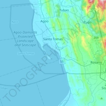
Name: Santo Tomas topographic map, elevation, terrain.
Location: Santo Tomas, La Union, Ilocos, Philippinen (16.19263 120.20158 16.30498 120.45308)
Average elevation: 60 m
Minimum elevation: -1 m
Maximum elevation: 867 m