Geolocate

Molinos topographic map

Click on the map to display elevation.

About this map

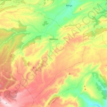
Name: Molinos topographic map, elevation, terrain.

Location: Molinos, Maestrazgo, Teruel, Aragon, Spain (40.75127 -0.55717 40.85516 -0.39695)

Average elevation: 977 m

Minimum elevation: 629 m

Maximum elevation: 1,384 m

Gear up for your next adventure:

🔥Emergency Fire Starter - Reliable ignition source for all weather conditions
🧢Outdoor Cap - Protective cap for sun and rain during hikes
🥾Waterproof Hiking Shoes - Durable shoes for wet and rugged trails
🥾Lightweight Hiking Boots - Boots for comfort and mobility on long hikes
🔦LED Headlamp - Hands-free lighting for early morning starts or late finishes

As an Amazon Associate, this site earns from qualifying purchases at no extra cost to you.