
Thank you for supporting this site ❤️
Make a donation
Make a donation
Gear up for your next adventure:
As an Amazon Associate, this site earns from qualifying purchases at no extra cost to you.
Balapur topographic map
Click on the map to display elevation.
Thank you for supporting this site ❤️
Make a donation
Make a donation
Gear up for your next adventure:
As an Amazon Associate, this site earns from qualifying purchases at no extra cost to you.
About this map
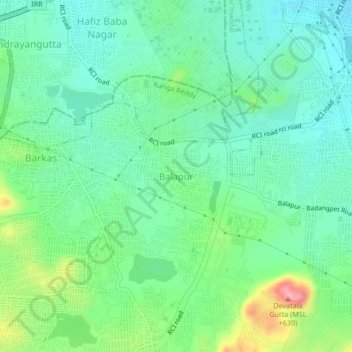
Name: Balapur topographic map, elevation, terrain.
Location: Balapur, Balapur mandal, Ranga Reddy, Telangana, 500021, India (17.28961 78.47994 17.32961 78.51994)
Average elevation: 539 m
Minimum elevation: 503 m
Maximum elevation: 631 m
Thank you for supporting this site ❤️
Make a donation
Make a donation
Gear up for your next adventure:
As an Amazon Associate, this site earns from qualifying purchases at no extra cost to you.